Log in
All resources
Create a design
33,250 Free Images of Astronomical Maps
maps made in the 17th century
geographical illustrations by coronelli
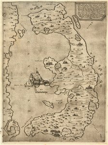
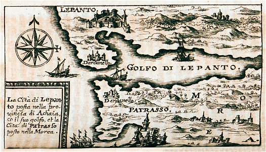
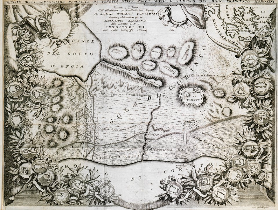
old maps of the peloponnese
remote views of acrocorinth
acrocorinth in art
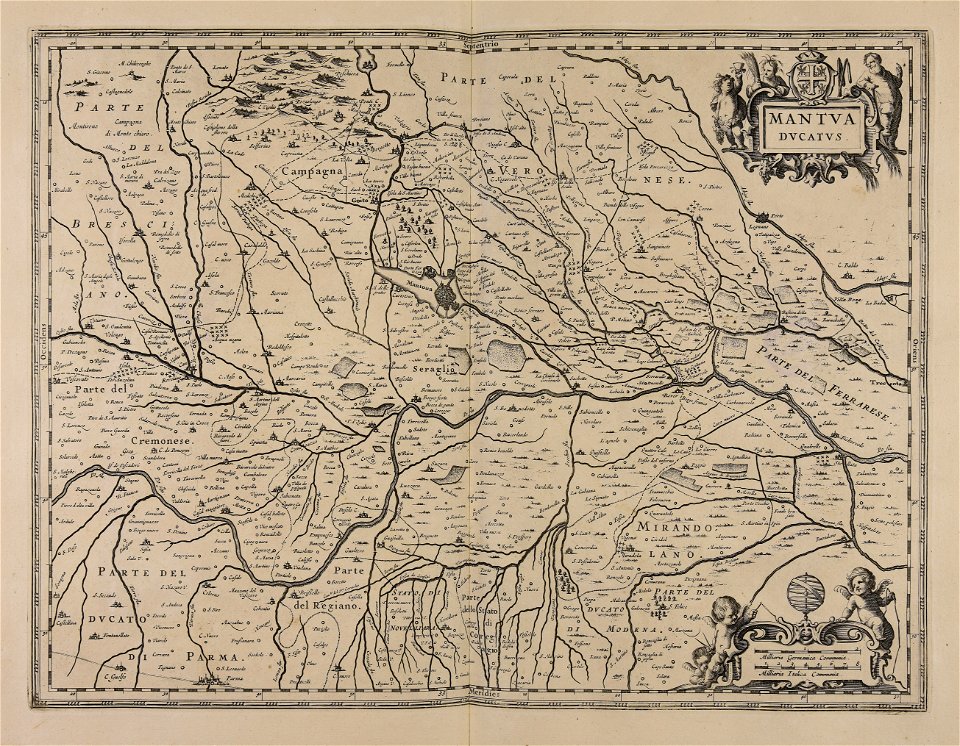
atlantis magni tomus secundus (biblioteca comunale di trento)
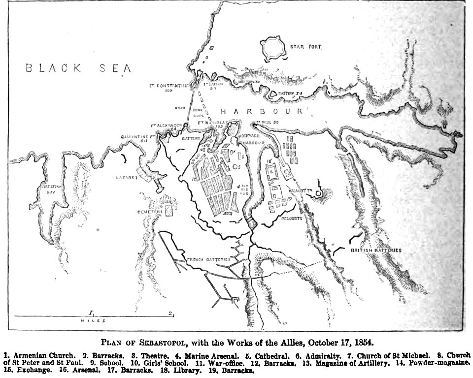
pictorial history of the russian war 1854-5-6 by george dodd
atlantis magni tomus quartus (biblioteca comunale di trento)
files from the bodleian libraries
maps from the mechanical curator collection
images from bristol past and present (1882)
bristol
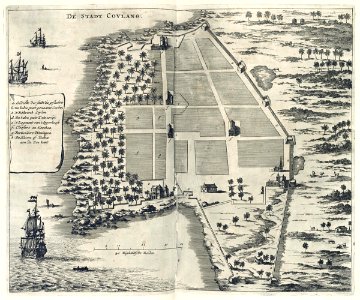
maps of the dutch east india company - india
1672
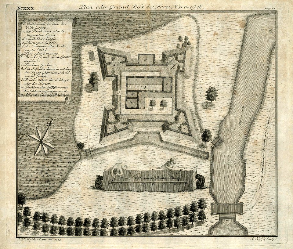
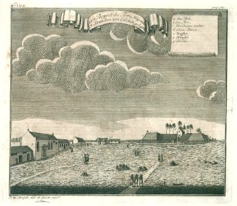
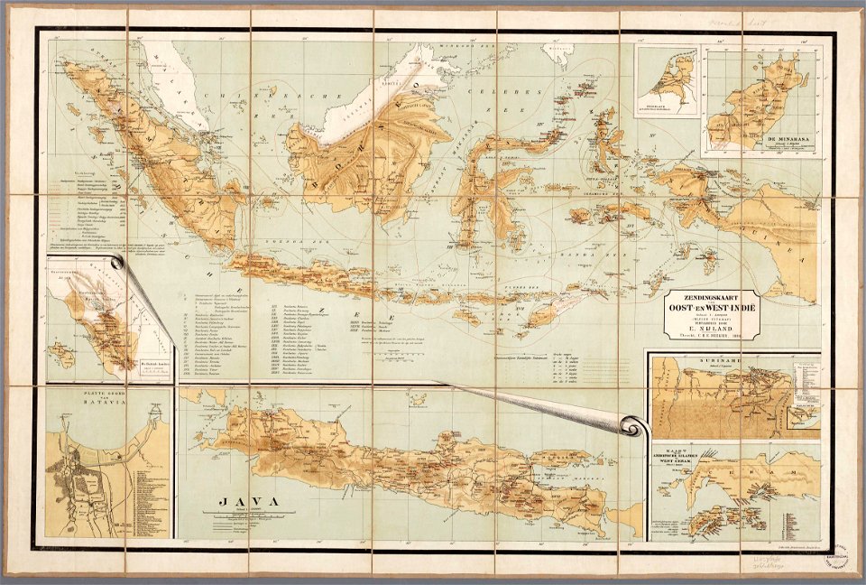
maps of the dutch east india company - indonesia
1739
media from atlas of mutual heritage on dutch east india company
1736
ottomar elliger (ii)
1726
maps of the west-indische compagnie
1773
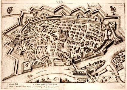
historical maps of ulm
history of ulm
illustrations of cosmographia (münster)
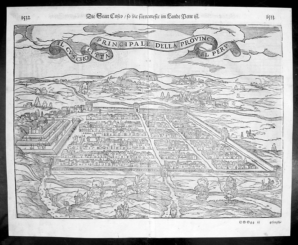
old maps of the viceroyalty of peru
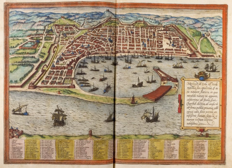
braun & hogenberg
historic port
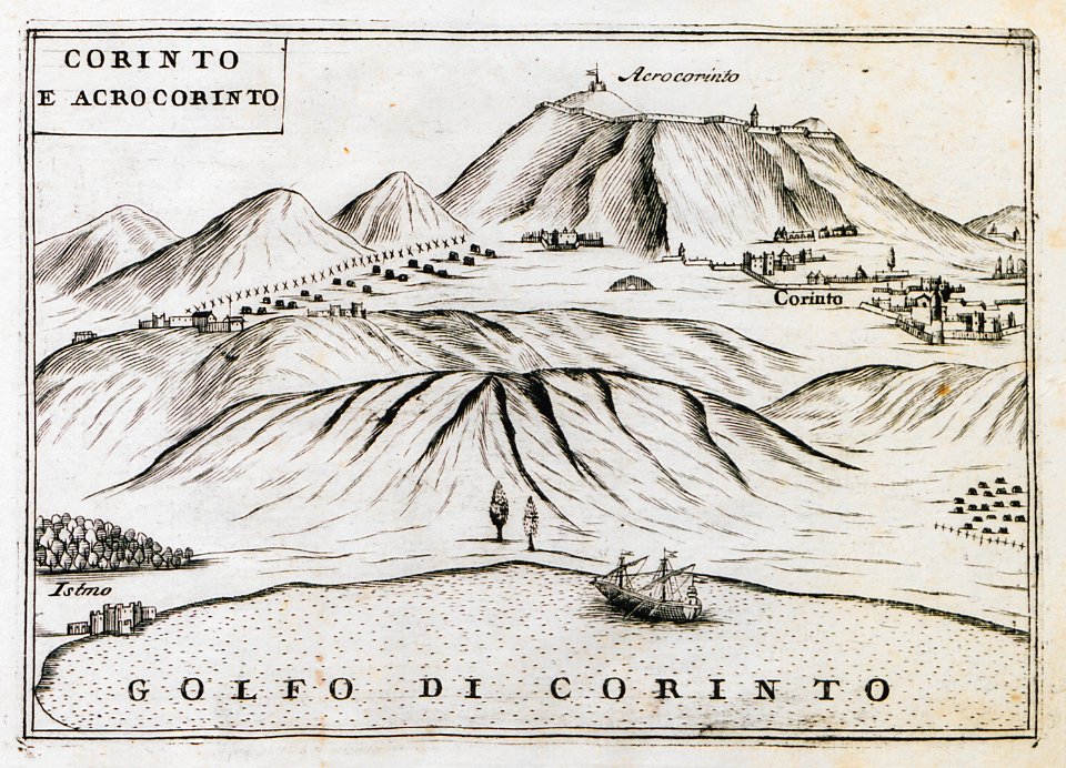
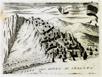
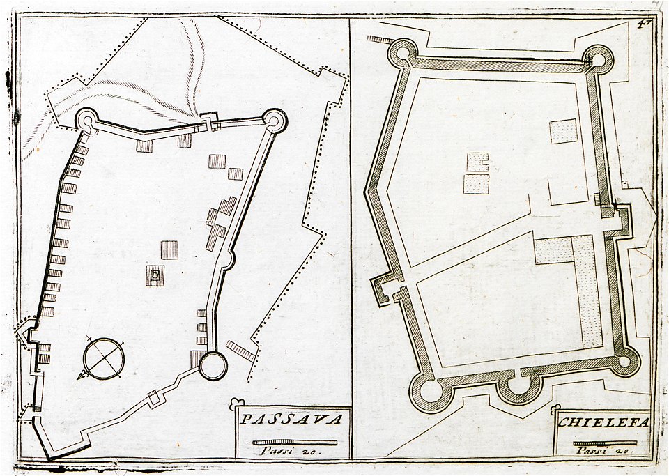
geographical illustrations by coronelli
remote views of acrocorinth
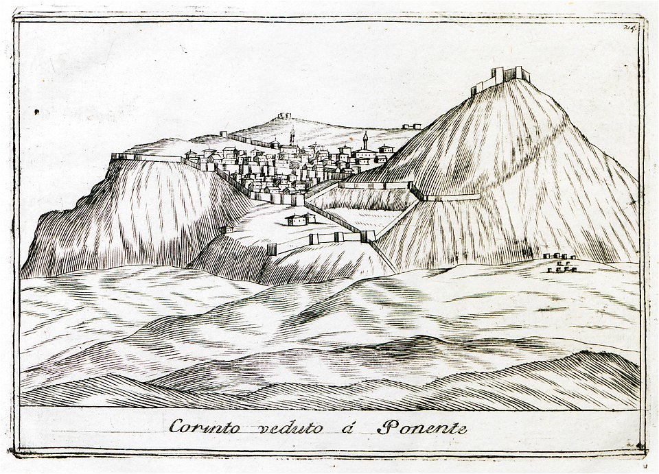
geographical illustrations by coronelli
remote views of acrocorinth
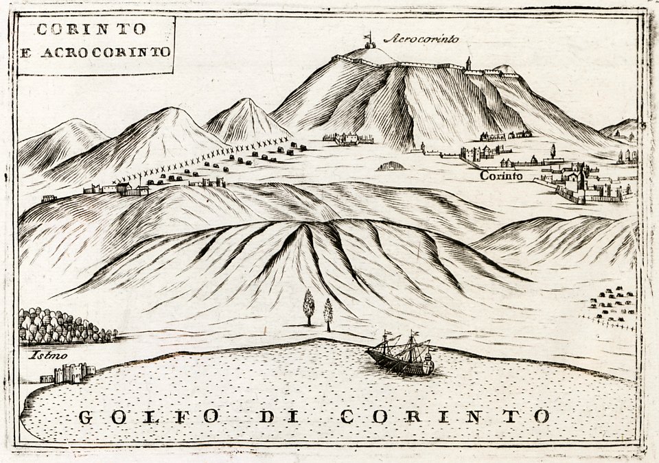
geographical illustrations by coronelli
remote views of acrocorinth
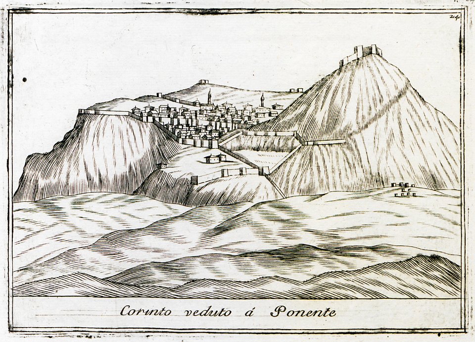
geographical illustrations by coronelli
remote views of acrocorinth
maps from the mechanical curator collection
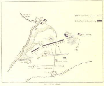
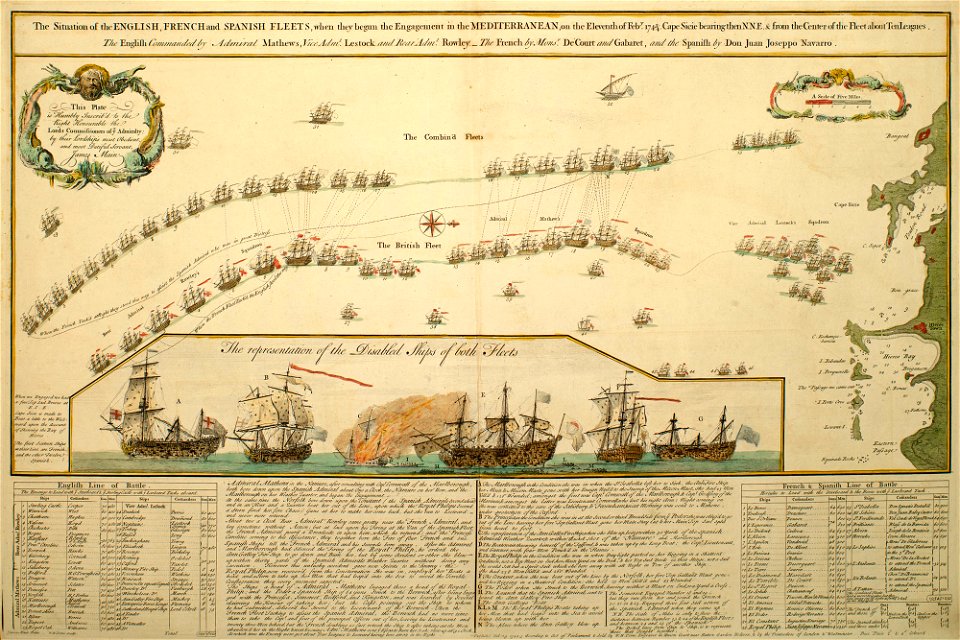
british battles on land and sea
british battles on land and sea
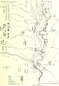
battle of the alma
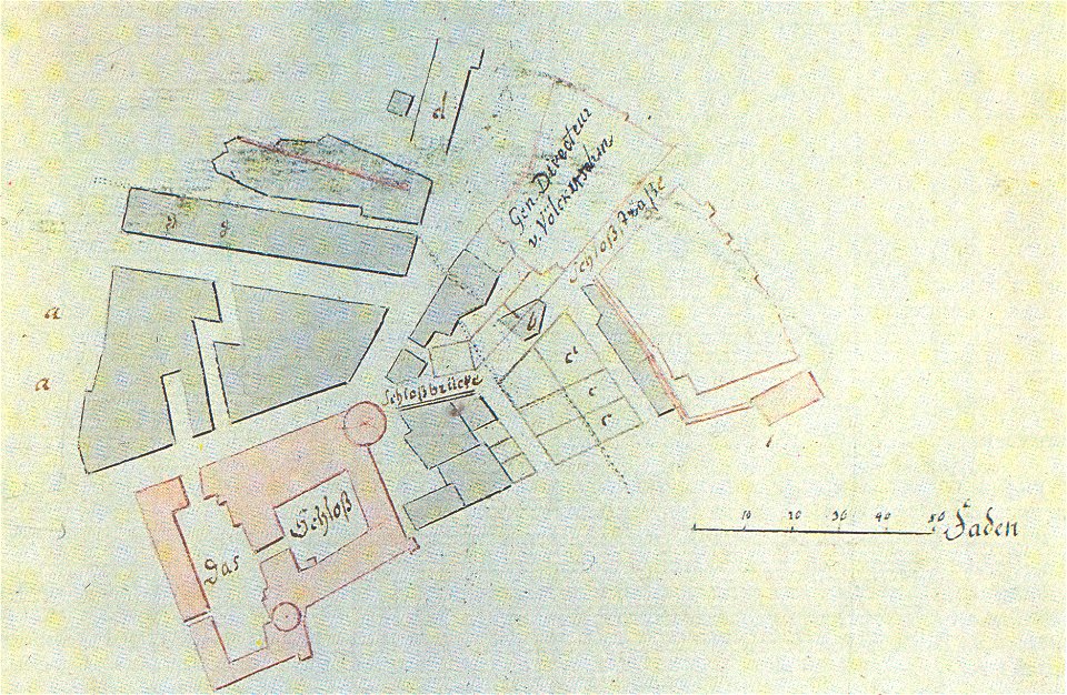
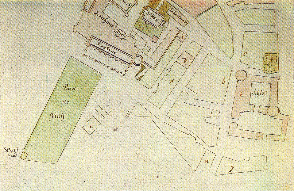
johann christoph brotze
old maps of riga
johann christoph brotze
old maps of riga
drawings in the universitätsbibliothek salzburg
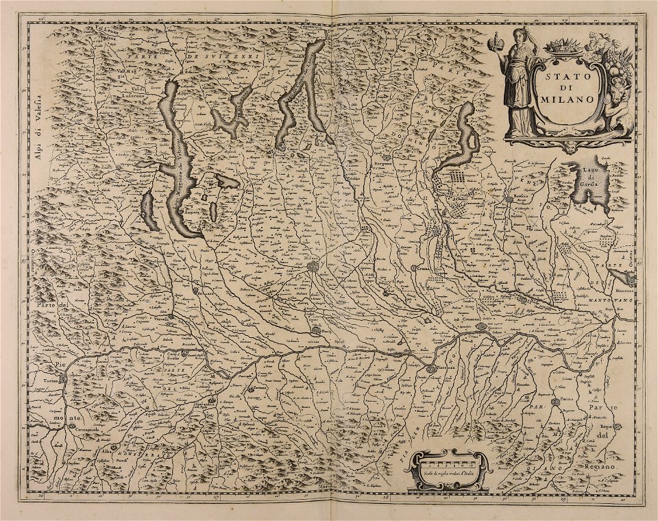
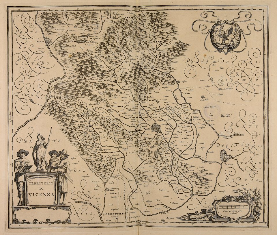
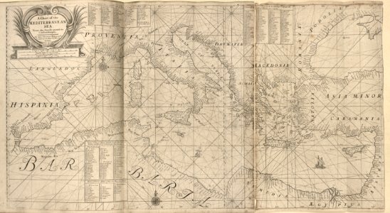
maps made in the 17th century
atlas van der hagen
copper engraving
atlas van der hagen
brigittenau
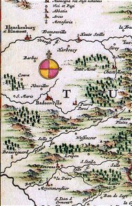
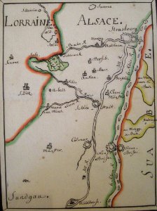
badonviller
blâmont
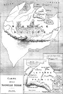
illustrations from second fatherland by george roux
maps of fictional islands
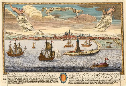
historical images of port of barcelona
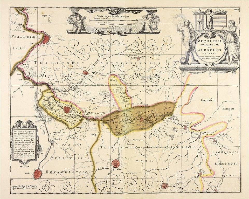
maps by joseph friedrich leopold
collections of the musée jean-frédéric oberlin
ban de la roche
17th-century maps of maastricht
siege of maastricht (1632)
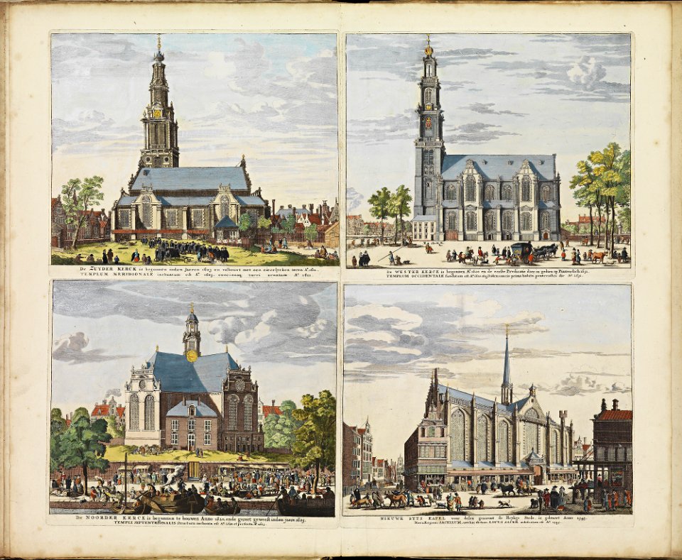
historical images of zuiderkerk (amsterdam)
frederick de wit
atlas de wit 1698
frederick de wit
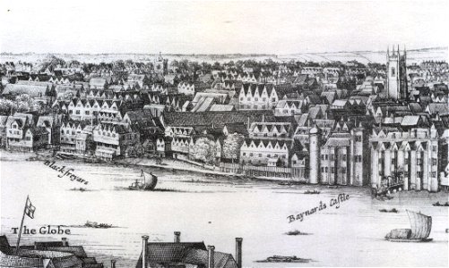
1647 in london
landscape art
old maps of gibraltar
history of gibraltar
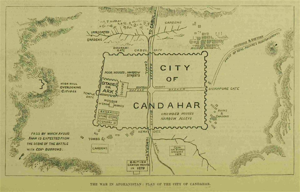
kandahar in the 19th century
battle of kandahar
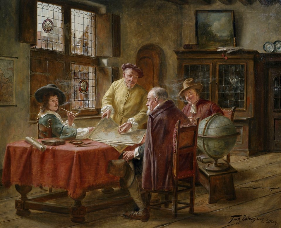
people with globes in art
people with maps in art
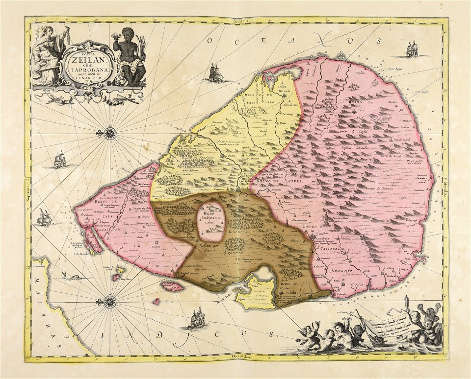
maps made in the 17th century
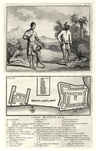
sri lanka
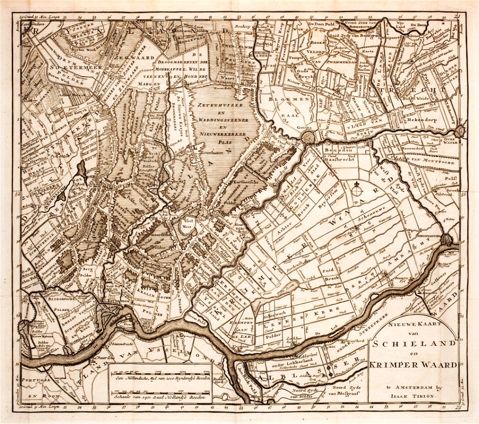
prints from isaak tirion hedendaegsche historie at the peace palace library
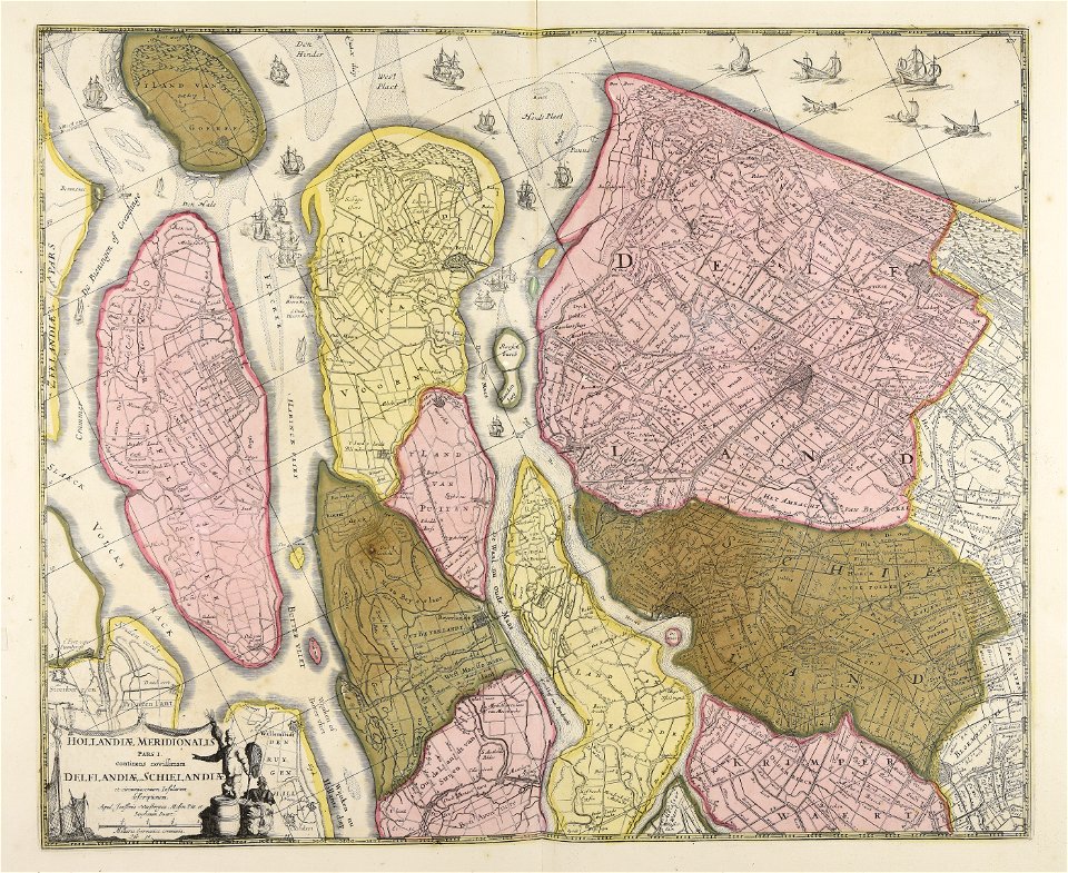
old maps of south holland
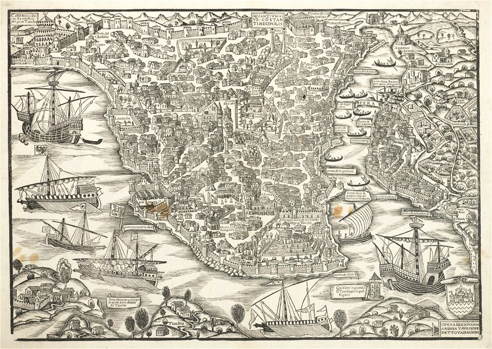
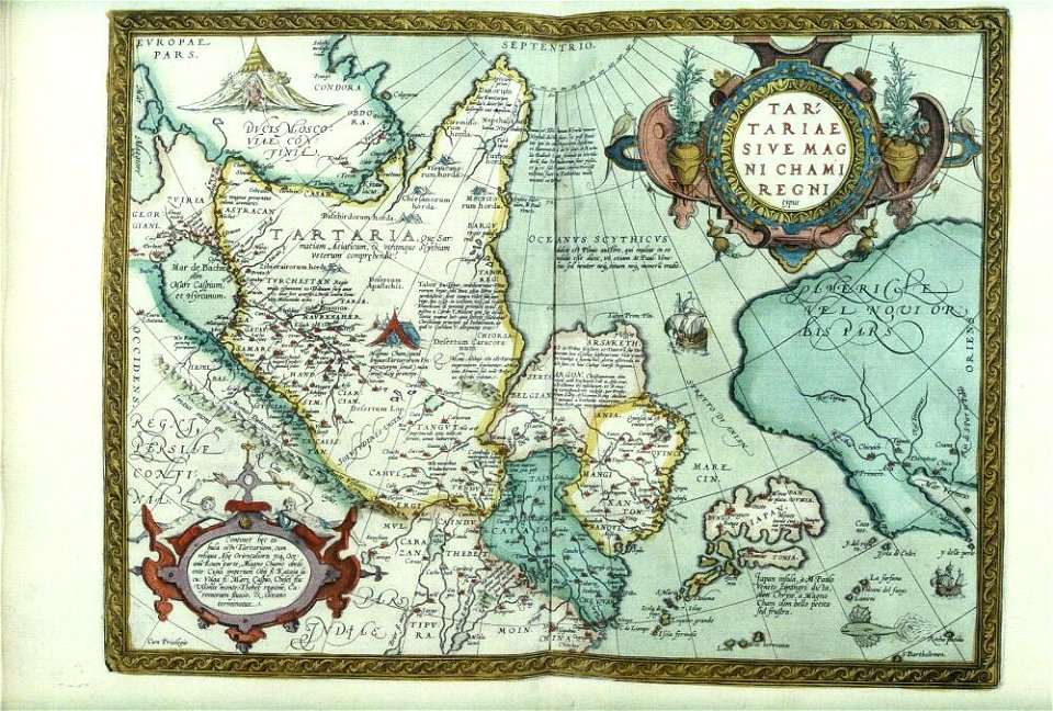
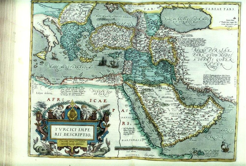
turkey in the 16th century
harvard university
atlantis magni tomus secundus (biblioteca comunale di trento)
maps made in the 17th century
atlantis magni tomus secundus (biblioteca comunale di trento)
maps made in the 17th century
harvard university
ferrando bertelli
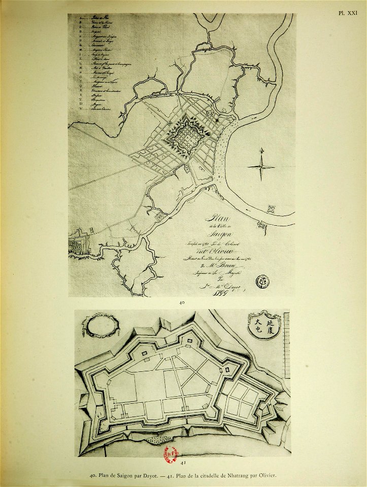
old maps of vietnam
sài gòn
kurtze beschreibung von republick venedig
17th-century engravings of towns
pictorial history of the russian war 1854-5-6 by george dodd
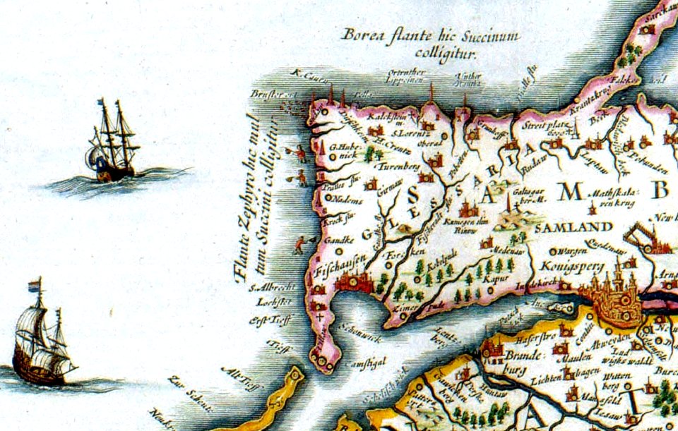
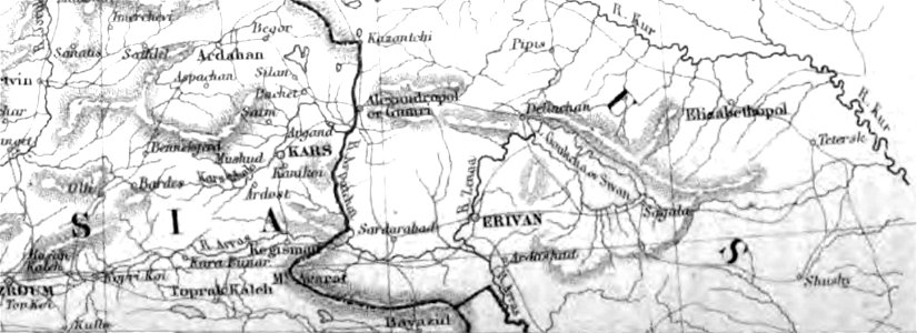
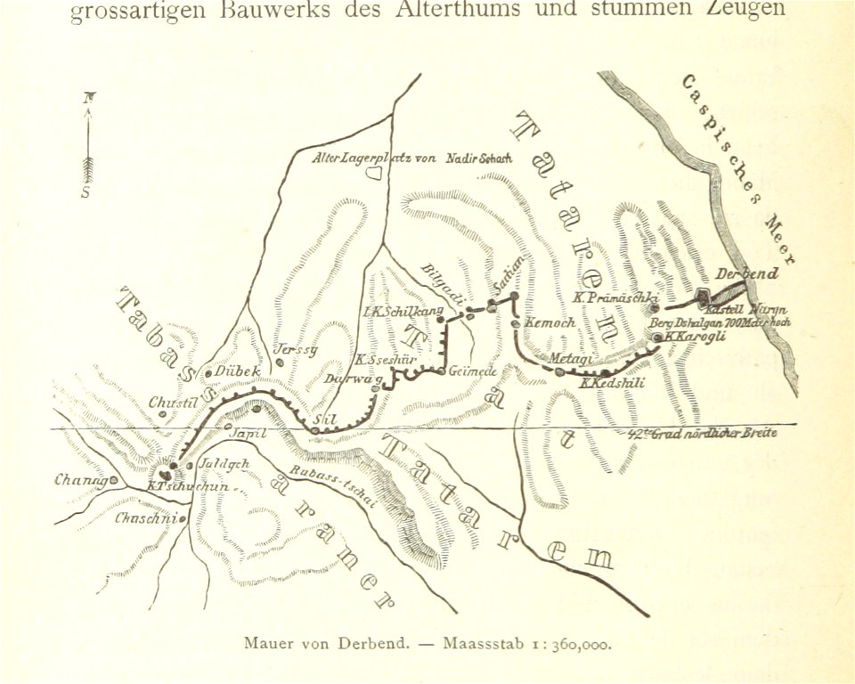
old maps of armenia
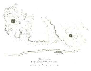
pyramid of amenemhat i
pyramid of senusret i
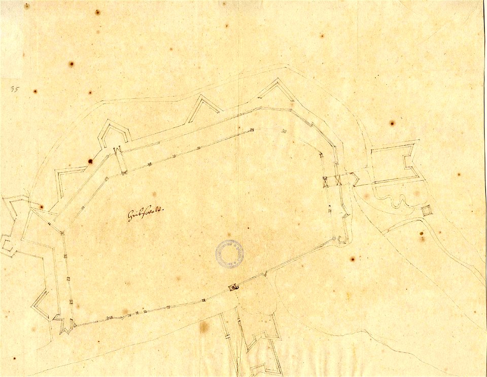
lepsius-projekt - fortifications
lepsius-projekt - maps
geographical illustrations by coronelli
old maps of the peloponnese
old maps of turkey
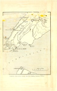
cape helles
pictorial history of the russian war 1854-5-6 by george dodd
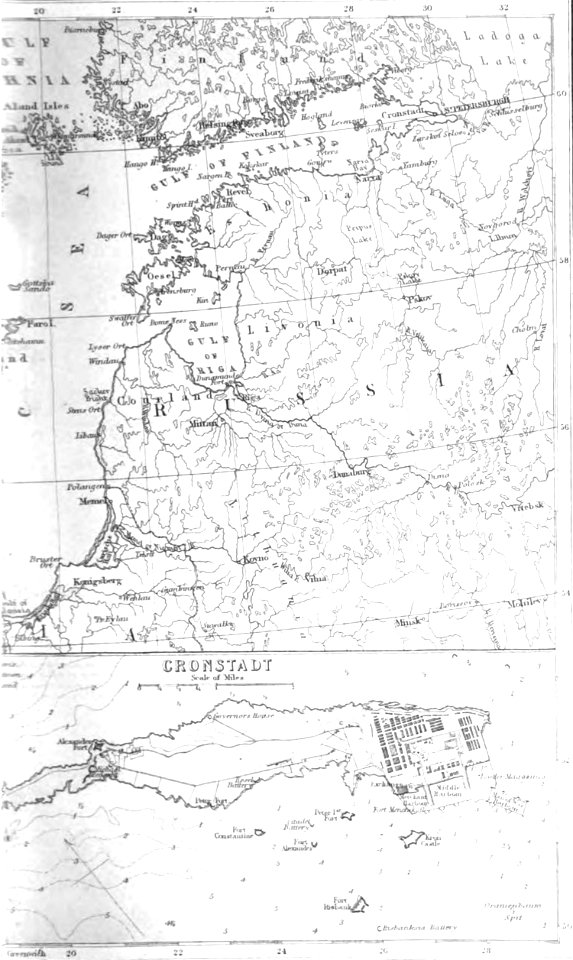
old maps of kronstadt
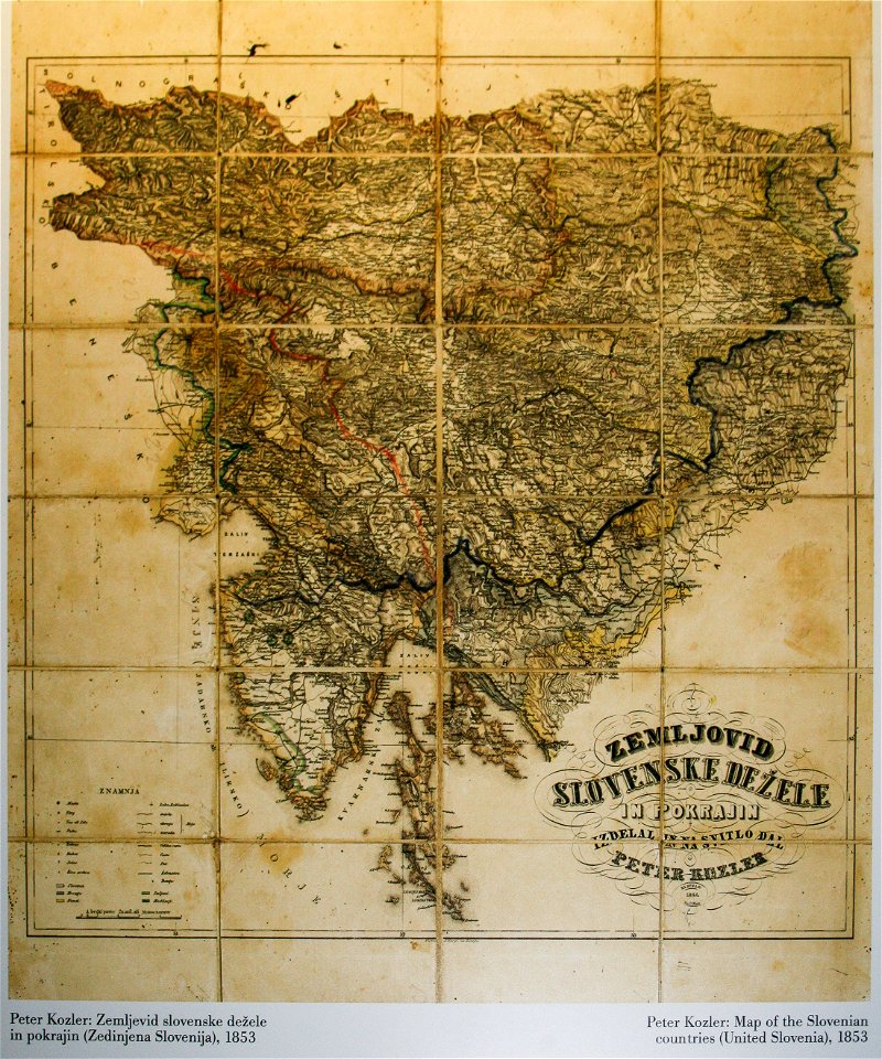
items kept by the national museum of slovenia
february 2008 in ljubljana
bibliothèque municipale de reims
rès. g 153
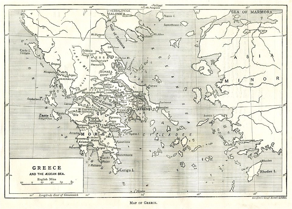
old maps of greece
greek pictures
atlantis magni tomus quartus (biblioteca comunale di trento)
maps made in the 17th century
atlantis magni tomus secundus (biblioteca comunale di trento)
maps made in the 17th century
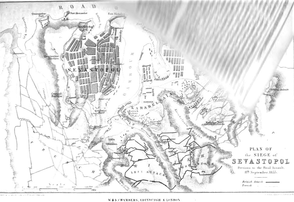
pictorial history of the russian war 1854-5-6 by george dodd
old maps of sevastopol
pictorial history of the russian war 1854-5-6 by george dodd
old maps of sevastopol
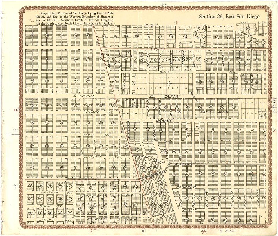
maps in the library of congress
california
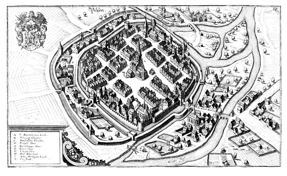
historical maps of plzeň
coats of arms of plzeň
slave ships
printing
atlantis magni tomus quartus (biblioteca comunale di trento)
maps made in the 17th century
atlantis magni tomus quartus (biblioteca comunale di trento)
maps made in the 17th century
atlantis magni tomus quintus (biblioteca comunale di trento)
maps made in the 17th century
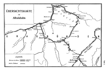
rail transport maps of switzerland
albula line
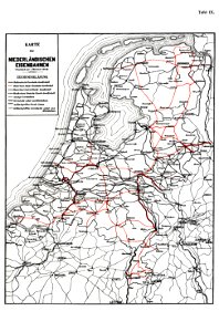
history of rail transport in the netherlands
enzyklopädie des eisenbahnwesens
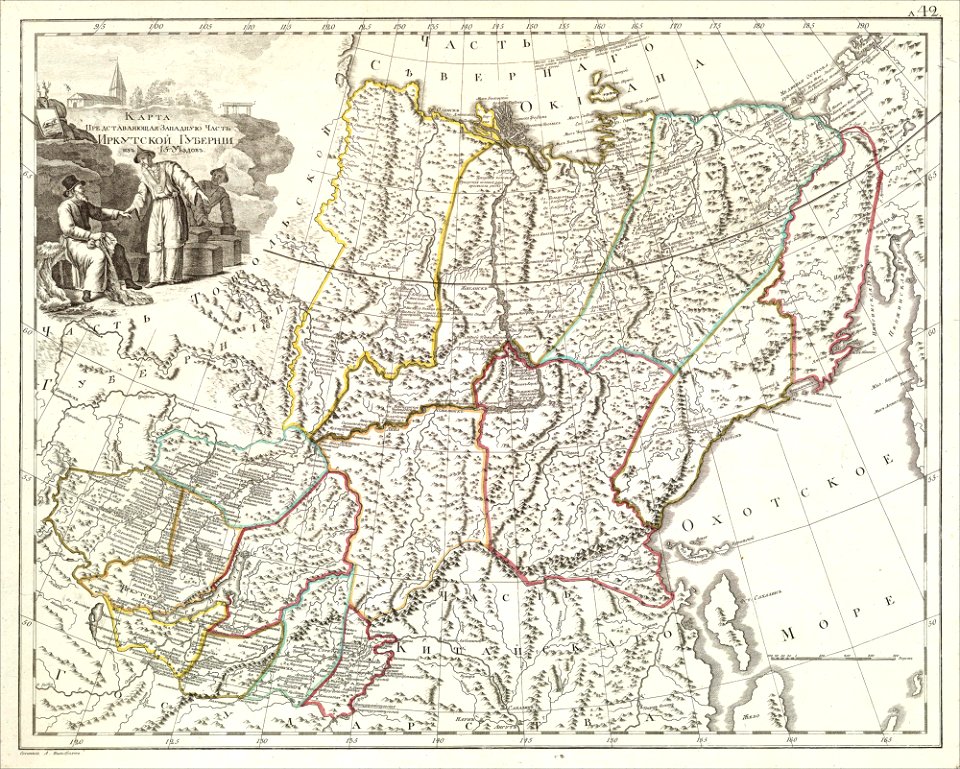
atlas of the russian empire (1800)
old maps of irkutsk governorate
engravings of topographia saxoniae inferioris
hildesheim in art
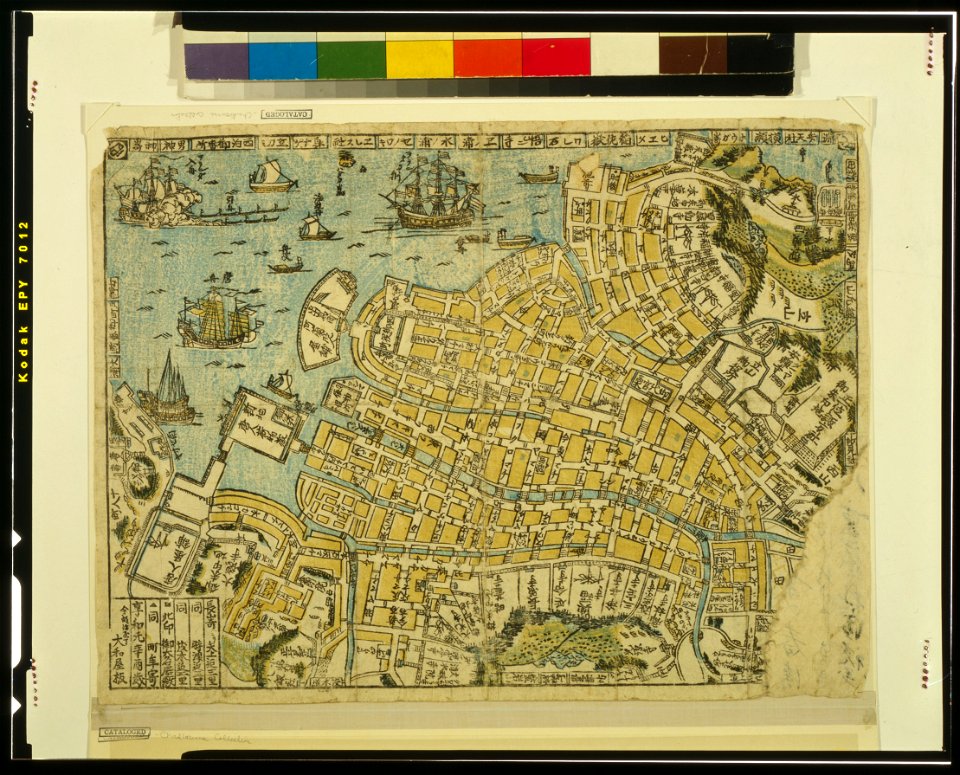
ukiyo-e by unknown artists
nagasaki-e
ukiyo-e by unknown artists
nagasaki-e
atlantis magni tomus quartus (biblioteca comunale di trento)
maps made in the 17th century
historical images of minsk
minsk
historical images of minsk
minsk
geographical illustrations by coronelli
old maps of the peloponnese
ou mémoires at the peace palace library
old maps of edinburgh
theatrum orbis terrarum (london 1606)
files from the bodleian libraries
files from the bodleian libraries
napoleonic wars
files from the bodleian libraries
old maps of the middle east
maps of voyages by christopher columbus
atlantic ocean
prints from selden mare clausum at the peace palace library
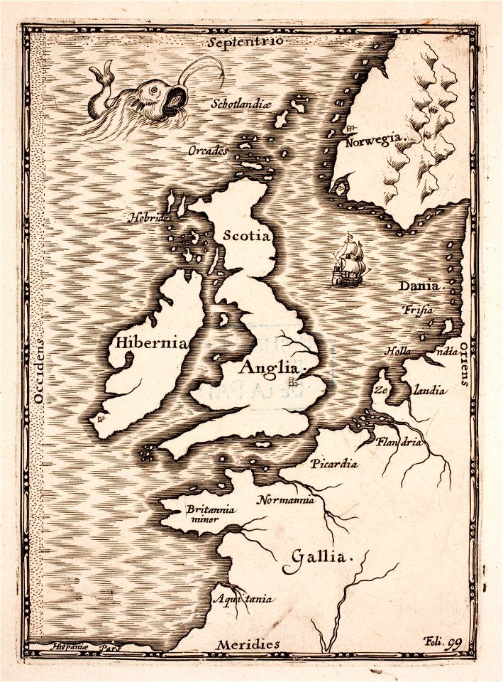
old maps of the british isles
christian mission in south america
christian mission in indonesia
maps of fortifications
arab–khazar wars
werdmühle (zürich)
zürich
atlantis magni tomus secundus (biblioteca comunale di trento)
maps made in the 17th century
austro-hungarian north pole expedition
images of vasárnapi ujság in 1874
the trouvelot astronomical drawings
zodiacal light
henry thomas colebrooke
henry weekes
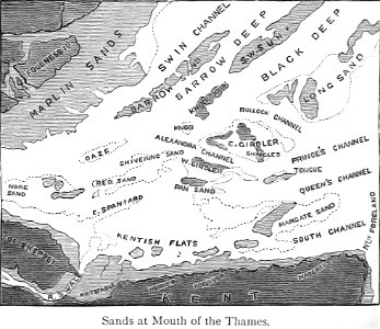
maps from the mechanical curator collection
buoy
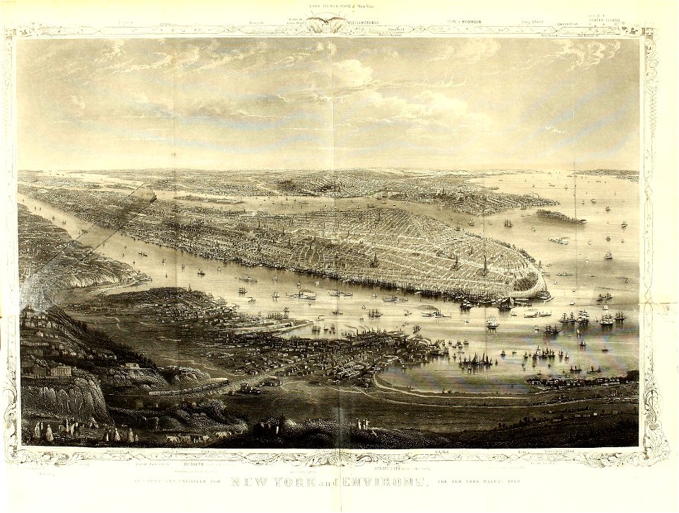
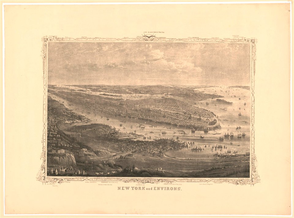
cornell university library
jr
new jersey
hoboken
new jersey
hoboken
new jersey
hoboken
the trouvelot astronomical drawings
mare humorum
the trouvelot astronomical drawings
jupiter (planet)
battle of the alte veste
1642 works in germany
river
roads
netherlands
wesel
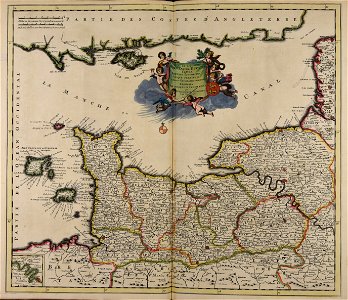
old maps of france
1730
astronomical objects on daguerreotypes
vega
nicolas iii de larmessin
gerardus mercator
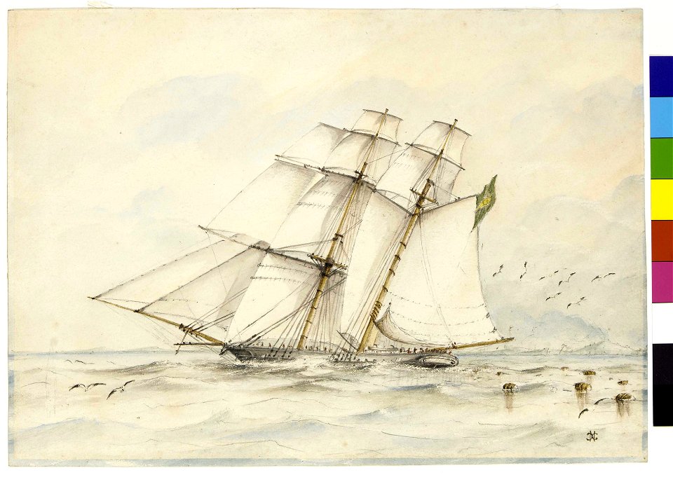
journal de relâches du croiseur ecole d'application l'iphigénie : campagne 1887-88
old maps of the balearic islands
theatrum orbis terrarum (london 1606)
files from the bodleian libraries
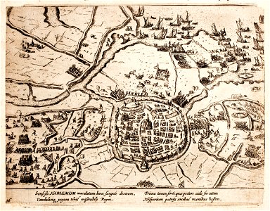
history of haarlem
siege of haarlem
charte von schwaben (bohnenberger)
19th-century maps of bavaria
geographical illustrations by coronelli
old maps of the peloponnese
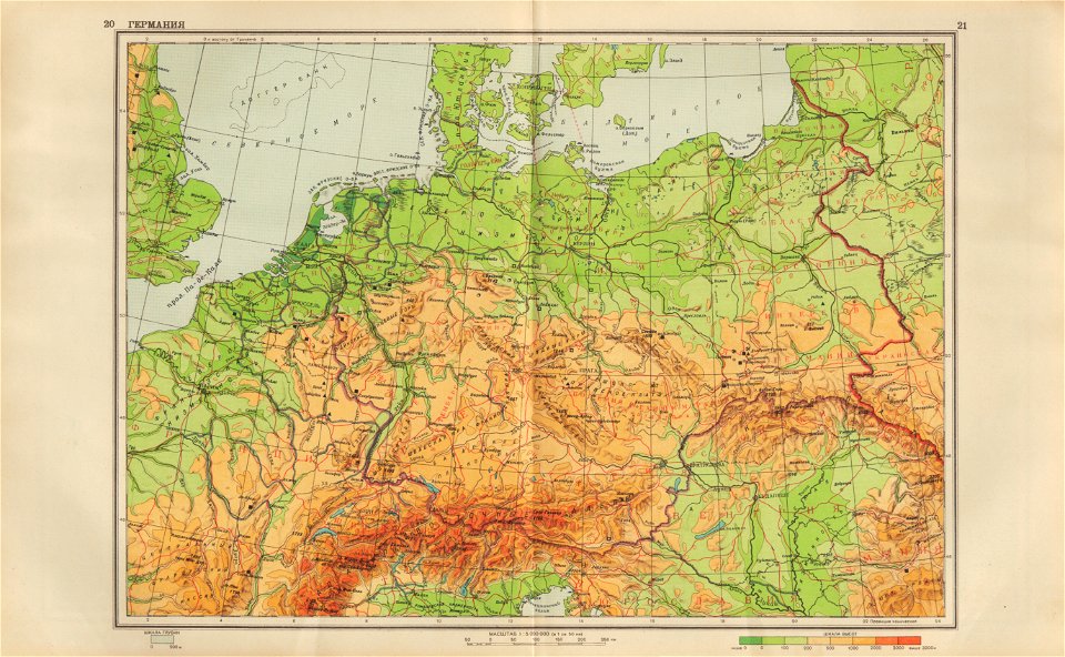
geographical atlas for the 5-6 grades of secondary school (1941)
old maps of the nazi germany
9001 - 9100 of 33,250
Next page
/ 333